Project showcase
Jaywick Sands Place Plan, Jaywick, for Tendring District Council, with HAT projects
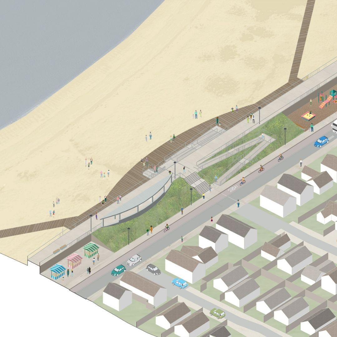
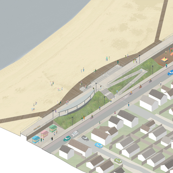
Tendring District Council is investing £120m into Jaywick Sands to address housing quality, the high flood risk and economic opportunity, as part of a 20 year placemaking plan, £84m of which is to be set-aside for flood defences. The project includes 139sqm affordable workspace in the Sunspot business centre, which includes a covered market.
Who is on the project team? (designer, consultants, etc)
Lead consultant, planning and design: HAT Projects
Viability and strategic consultancy: Chris Brown, founder, igloo Regeneration
Cost consultant: Potter Raper Partnership
Early stage input from DK-CM and Maccreanor Lavington
Describe the context of this initiative or project, its neighbourhood and the community it serves?
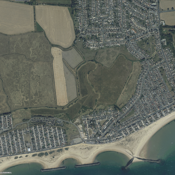
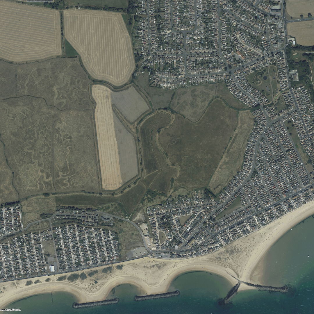
The Jaywick Sands Place Plan is a regeneration strategy for the seafront community of Jaywick Sands, which is at high risk of flooding as well as experiencing severe deprivation. Jaywick Sands was founded less than 100 years ago as a plotlands development of self-built chalets on tiny plots, never intended for permanent occupation. After WW2, many chalet owners started to live full-time in the community despite the chronic lack of basic infrastructure, but the local authority resisted this shift, and refused to provide services for many years. As a result of this history, Jaywick Sands has a hugely resilient community spirit, but is statistically the most deprived place in the country, with income deprivation, poor health, unemployment and poor quality housing. Jaywick was built on a tidal salt marsh, and in the 1953 flood, 35 people died and hundreds made homeless. The sea defences were improved, but climate change means the standard of protection provided by these defences is decreasing year on year. By the end of this century, a 1953-style flood would result in depths of over 4m of water in over 1800 homes, most of which are still flimsy chalet-style bungalows with little resilience. The Place Plan addresses the objectives set out for Jaywick Sands in the Tendring Local Plan, which are to transform housing quality and the built environment; ensure long term flood resilience; create greater connectivity to neighbouring areas; create new economic opportunities; and improve people’s life chances, access to public services & health & wellbeing.
Describe the intervention you’ve made, including its purpose and motivation? How it will contribute to climate resilience.
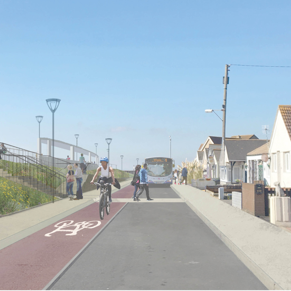
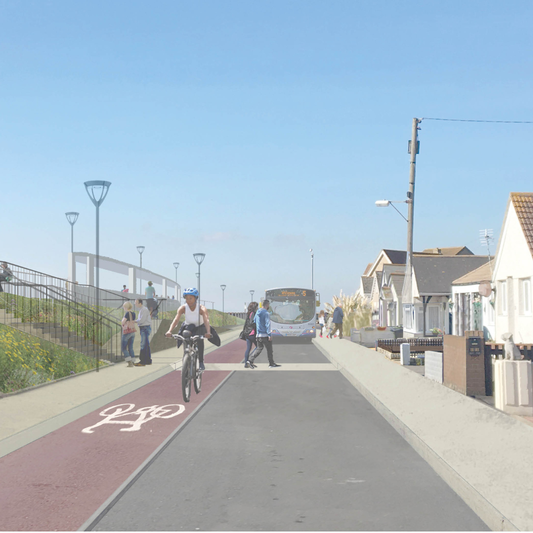
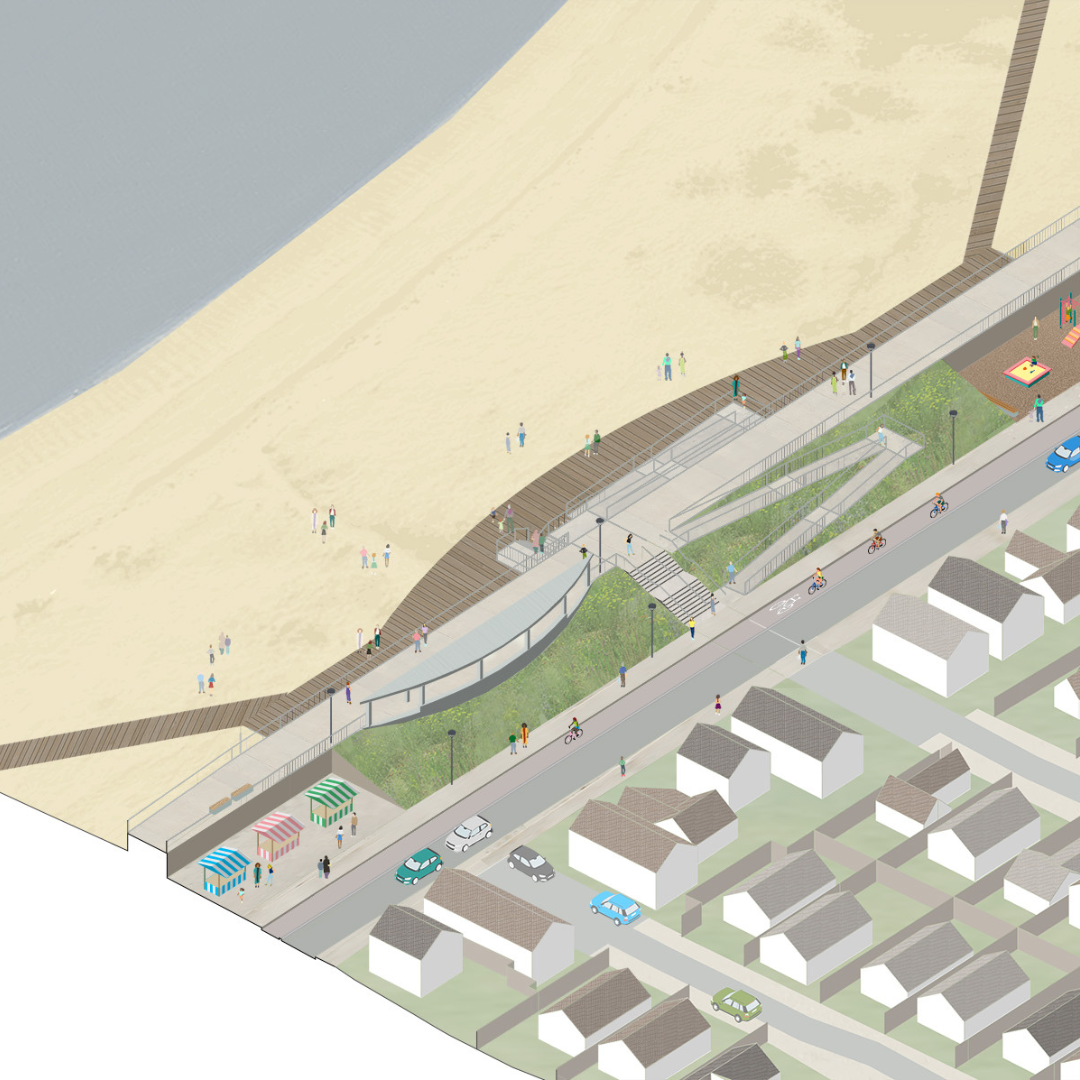
The Jaywick Sands Place Plan is a framework for physical regeneration over the next 20 years. Improving the flood defences and the flood resilience of the community is paramount and a precondition for any other projects or investment. And while improved defences do reduce the risk of a catastrophic flood, much needs to be done at a household level to improve the physical resilience of homes in the case that a flood does occur. More fundamentally, people experiencing multiple deprivation, poor housing quality, poor health and income inequality are far less able to cope with the impacts of even mild flooding, so addressing the challenges that Jaywick Sands experiences are intersectional. But the reason Jaywick Sands exists – and why its community love living there – is the exceptional beach. New flood defences must not sever the community from the sea and should maximise the beach as a social, economic and environmental asset. The Place Plan proposes a framework for improved flood defences that also improves accessibility to, and use of, the beach by residents and visitors – and integrates other community facilities and public realm improvements. Unlike previous strategies for Jaywick Sands, the Plan does not propose blanket redevelopment of housing, but sets out a process for gradual improvement, working with homeowners, and redeveloping derelict and vacant plots. Other proposals include a new access route that will shorten the distance to the nearest primary school, but also serve for flood safe emergency access and egress in a flood event.
Explain the environmental and social impact of the project?
The environmental and social impact of the Place Plan has the potential to be transformational for the community, delivering a high standard of flood protection for the next century as well as significant improvements to the quality of life and access to jobs and opportunities for residents. Currently, in the most deprived parts of Jaywick Sands, it is estimated that half of all homes may not meet the Decent Homes standard, and almost none have basic flood resilience, and the quality of the public realm is blighted by derelict homes and vacant plots. Investing in flood defences will underpin investment in homes by both public finance and the private sector, and the seafront public realm design approach would make the beach the most accessible in the county for wheelchair users and families. For a community of 3000 people within the flood zone, there are very few jobs accessible, so increasing business activity is vital. The first steps to achieving this have already been taken with the opening of Sunspot, a 1500 sq ft affordable workspace building including a covered market, which is a direct result of the research underpinning the Place Plan. This provides 24 affordable business units, including retail, workshop and office/studio spaces, and is nearly fully let despite only opening in September. The Place Plan sets out a deliverable route map to regeneration without displacing the community who love and value the unique character of Jaywick Sands.
Gallery
Festival of Pineapples
24-26 February 2026
Pineapples prize giving night
April
Pineapples at Festival of Place
10 June 2026
© The Pineapples - Tweak Ltd. 124 City Road, London, EC1V 2NX. Tel: 020 3326 7238
